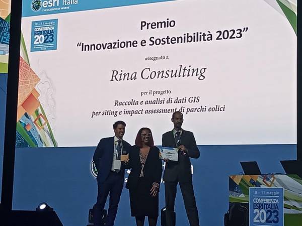
Esri Italia conference: RINA wins the "Innovation and Sustainability 2023" award
12 May 2023
How to exploit the potential of GIS for the creation of offshore wind farms

The ESRI conference is one of the most important events in Italy for companies, government agencies, academics and other professionals interested in GIS technology.
What is GIS technology?
GIS means geographical information system and allows you to map any type of data. In particular, GIS technology applies the science of geography with collaborative tools, helping people gain actionable insights from all types of data. Basically, GIS connects data to a map, integrating location data (where things are) with all kinds of descriptive information (how things are in that specific area).
Our innovation: GIS technology for environmental sustainability
How to achieve the "No Net Loss - Net Gain" biodiversity objective?
How to produce more energy from renewable sources and reduce CO2 emissions?
How to identify suitable areas for the creation of offshore wind farms both on the Italian and European coasts?
The answer to these questions can be found in some innovative services that make use of the professional and multidisciplinary use of geographic GIS software.
We collect and analyse the main environmental geospatial descriptors of interest using GIS functions (geospatial analysis, remote sensing at different scales). This analysis makes it possible to identify the suitable areas characterized by the least presence of environmental constraints, where to position the wind farm areas and define the concept of the wind farm project in its main components.
Our innovative approach consists in the representation and analysis in a digital environment of the entire energy asset and its relationships with the environmental components, also for the subsequent phase of assessing the environmental impact of the project.
Finally, the use of GIS is fundamental in the mapping and analysis of biodiversity in the concept development phase (through the analysis of literature data), in the identification and evaluation of potential significant environmental impacts (through the interpretation of the results of field survey) and in the construction and operation phase of the project (by monitoring the evolution of the environmental state of the places).
What are the next steps?
The use of GIS tools has multiple applications that can be developed to support environmental studies.
Explore our environmental engineering and biodiversity and ecosystem services and contact us to learn more about the new tools we are developing.