Unlock the full potential of GIS and data for informed decisions and transformative outcomes with RINA North America

RINA’s GIS team partners with clients in the utility, campus, government, transportation, and industrial sectors to unlock the full value of location-based data. As a comprehensive geospatial solutions provider, RINA supports clients with strategy, planning, data management, application development, system configuration, integrations, analytics, and field mobility solutions. With an eye toward functionality, usability, and long-term business value, our team helps clients transform complex data into practical tools that support informed decisions, operational visibility, asset management, and measurable outcomes.

Met by the federal Tracking & Traceability mandate, the City of Monroe needed a mobile technology solution that would allow them to scan and decode barcodes on natural gas pipeline materials as they were being installed in the ground. We were responsible for developing a revised data model and customizing Esri's Field Maps to meet this need. Our team utilized Arcade Expressions, combined with offline data capture to streamline workflows, improve field crew efficiency, and enhance the quality of data being collected.
our ability to provide GIS services with the combination of applicable field experience is what led to the overall success of the mobile solution. The combination of experience from both GIS and natural gas operations allowed we to provide a solution that focused on the field crew's ability to use the technology, leading to widespread adoption and trust across the solution was providing the best organization.
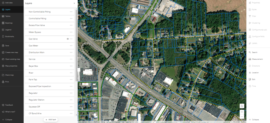
To overcome operational inefficiencies, Hull Municipal Light staff sought to convert their AutoCAD-based data into Esri's Utility Network. Our team was responsible for migrating the data, performing cleanup tasks, and working closely with stakeholders to identify business rules and regulatory requirements for the new model. Beyond data conversion, we deployed ArcGIS Enterprise and Field Maps that enabled Hull field crews with a modern, digital workflow that allowed them to view assets and capture inspection information in real-time.
With the deployment of a full Network Information Management System, Hull Municipal Light can now interact with and perform analyses on their entire network both online in the office and offline in the field. For the first time, Hull has a common operating picture that is reliable, scalable, and integrated across their organization.
Our Qualify with Confidence (QWiC) tool was deployed at Wide Open West (WOW!) to streamline serviceability analysis for new telecommunications builds across their service territory. Previously, WOW!'s process involved multiple systems and tools that resulted in inefficient cost estimating, costing the organization time and resources.
Deploying QWiC has allowed WOW! to integrate seamlessly with their existing Esri platform and data, analyzing their plant for the most efficient and least cost path to build. The result is a comprehensive network dataset that produces three distance-based routes for each qualify quote. The Sales Team is then able to select the best route for each individual location or run a bulk process to see multiple sales opportunities in one single view. For the first time, WOW! has an integrated tool that enables their organization with efficient serviceability and cost analysis.
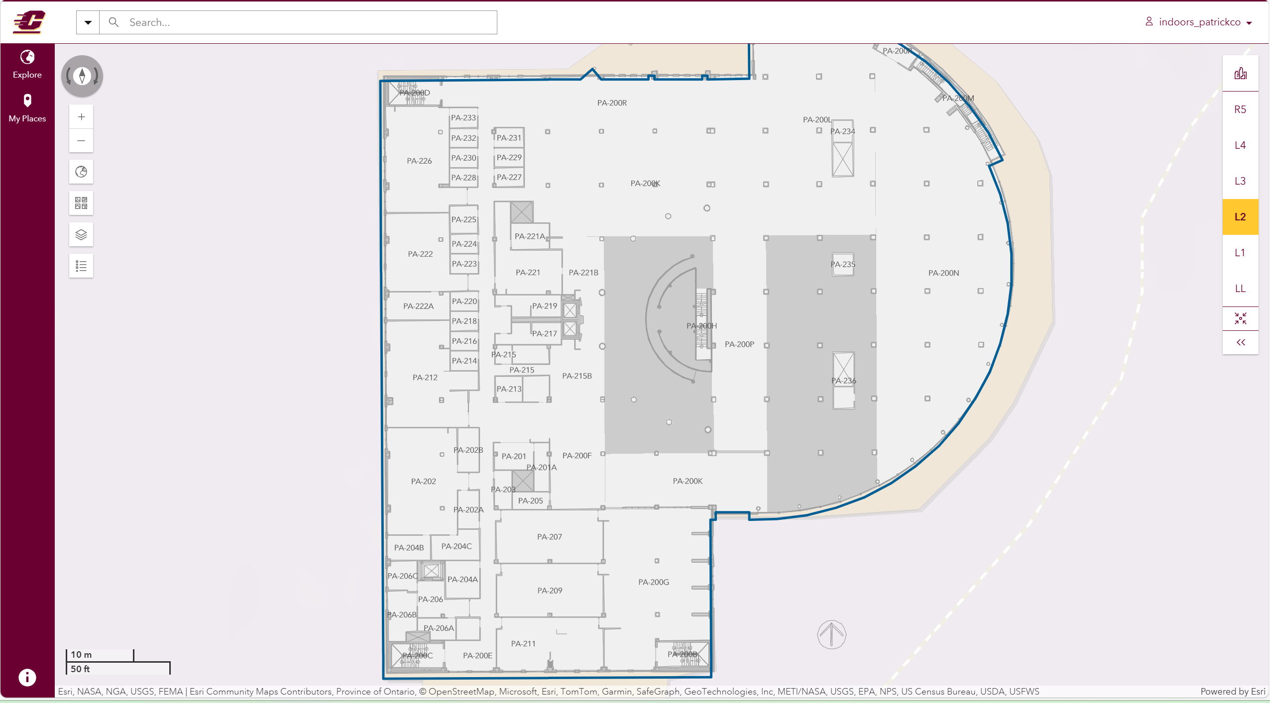
Central Michigan University (CMU) was looking for a qualified vendor to provide CAD services, GIS data, mapping, and solution implementation services focused on Esri's ArcGIS Indoors technology. CMU contains over six million square feet of building space on their campus in Mount Pleasant, Michigan. With over 15,000 students, the campus manages 115 facilities. To better manage the space, CMU chose a web-accessible GIS solution to visualize floorplan layouts and space types. To best serve CMU's current stated requirements, we assessed CMU data and system readiness to deploy ArcGIS Indoors.
We used our internal CAD team to perform the CAD work. Our staff are very familiar with a variety of methods for extracting and converting space data provided in CAD, BIM, PDF, and other static formats to ArcGIS with data model specifications. This activity also included the setup of extract, translate, load or ETL tools used to automate the process of updating and maintaining ArcGIS Indoors as CMU floorplans change over time. We prepared CMU space plans for ArcGIS Indoors and subsequently configured the ArcGIS Indoors Maps standard apps (e.g., Indoors Viewer, Indoor Kiosk, Mobile, etc. apps). Our team also developed navigable Points of Interest (POIs) based on CMU priority destination points and asset locations.
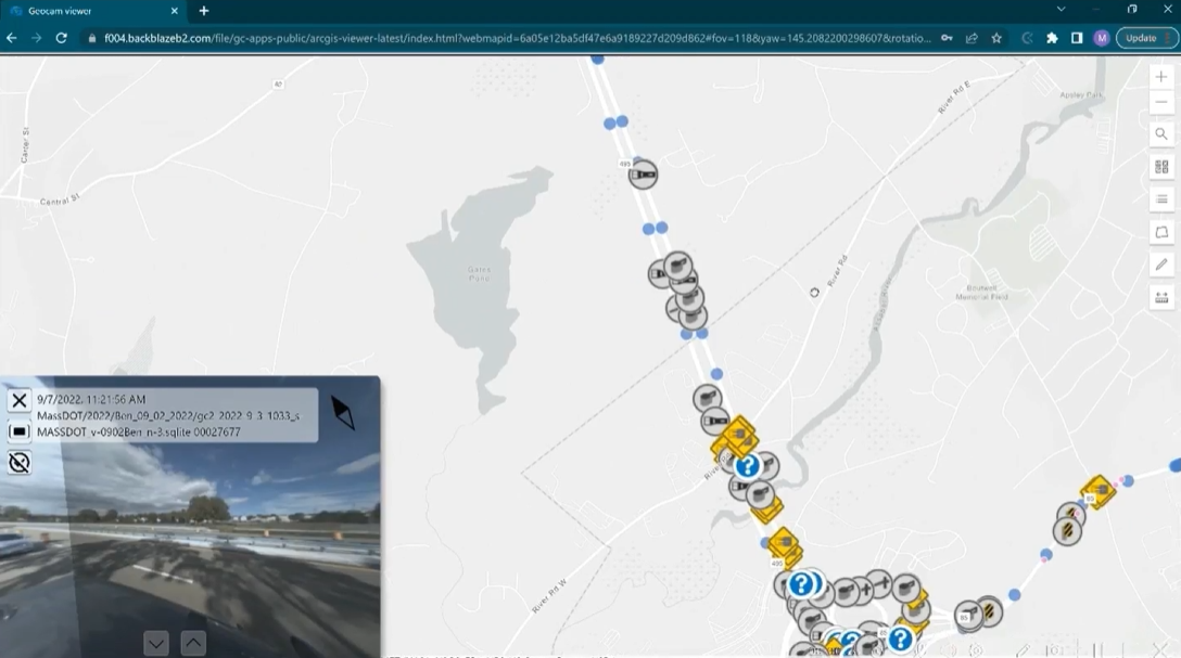
Guardrails are an important component to the roadway network as they provide a safety barrier for motorists. A proper inventory of physical aspects of the guardrail and end terminal (both crash cushions and end treatments) is pivotal to help understand capital needs, safety assessments, and maintenance obligations. Guardrail, guideline, and guardrail end treatments along interstates, ramps, and DOT highway miles are all under the purview of MassDOT maintenance. Their responsibility for planning begins with a proper inventory of the asset with location information. We, along with our data collection subconsultant, GeoCam, and our QAQC subconsultant, AI Engineers, inventoried the guardrail and end terminal data for state-maintained roadways across the commonwealth of Massachusetts (~3,017 centerline miles). This project created a searchable source of GIS information about quantities of end treatments by type and other key attributes. The data will provide MassDOT with the information to properly fulfil this aspect of their jobs through asset planning and maintenance.
Our team's ability to limit consultant risk was important in the project. Using the innovative spatially-enabled 360 Imagery to collect images and GPS locations along the roadways, the team created GIS features with type identification, guardrail characteristics, and sub 30cm accuracy. This minimizes time in the field, does not put personnel at risk in the ROW, and provides MassDOT with a direct image on the guardrail and/or end terminal. Collection was completed with one car in the field and data processed with machine learning models to help automate asset extraction. The imagery collected can also be used to extract other features in the same way it is being used for guardrail. Other assets such as signs, stripping, and lighting (and more) can be generated from this same initial effort, thus creating more value to the DOT and the traveling public.